Conservation Commission
Shelton, Connecticut

CRI MENU
- CRI Home
- Scenic Resources
- Historic Resources
- Ecological Resources
- Agricultural Resources
- Water Resources
Connecticut CRI Data for Shelton
 SCENIC
RESOURCES
MENU:
- Scenic - Home
- Housatonic River
- Water Resources (Other)
- White Hills Agriculture
- Agricultural (Other)
- Riverview Park
- Scenic Roads
- Downtown Shelton
- Other
 White Hills Agriculture
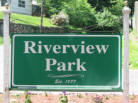 Riverview Park
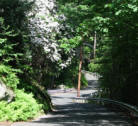 Scenic Roads
Water Resources (Other)
Downtown Shelton
 Agriculture (Other)
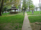
Riverview Park - Scenic Resource Inventory
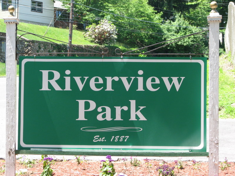 The City's first park, located on the northern edge of
downtown Shelton, has been a major attraction for many years.
The playground and baseball fields bring the greatest number of
visitors to the park, many of whom are not aware of nearby
features such as the hiking trail, Constitution Oak, or Pootatuck
Indian rock. Scenic features at the park are listed
individually below.
See map.
The City's first park, located on the northern edge of
downtown Shelton, has been a major attraction for many years.
The playground and baseball fields bring the greatest number of
visitors to the park, many of whom are not aware of nearby
features such as the hiking trail, Constitution Oak, or Pootatuck
Indian rock. Scenic features at the park are listed
individually below.
See map.
-
Attributes: VIEW - Ousatonic Dam
overlook. HISTORY - Oldest park in Shelton, historic
markers, site of Pootatuck Indian fort. PARK - Ammenities
include playground and ballfields. PUBLIC RECREATION -
Playground, baseball, basketball, hiking. SPECIMEN -
Constitution Oak. FEATURES - Listed below.
AT RISK - View of Ousatonic Dam may be impacted by
proposed removal of gatehouse for a fish ladder and filling of
canal for development.
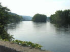
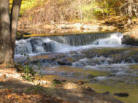
Riverview Overlook
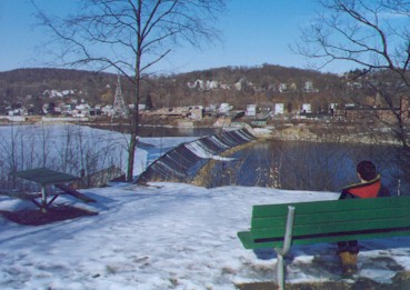 A scenic overlook of the Ousatonic Dam is maintained alongside the
park access road. People once lined the banks of the park to watch Yale
rowing races, but the trees now obscure much of the view. A bench and
picnic table now mark the location.
A scenic overlook of the Ousatonic Dam is maintained alongside the
park access road. People once lined the banks of the park to watch Yale
rowing races, but the trees now obscure much of the view. A bench and
picnic table now mark the location.
-
Attributes: VIEW - Ousatonic Dam
Overlook. HISTORY - First park, historic dam complex. PARK - PUBLIC
RECREATION - Picnicking. FEATURE - Dam. AT RISK - - View of Ousatonic Dam
may be impacted by proposed removal of gatehouse and filling of canal for
development.
Fishing Boy Statue
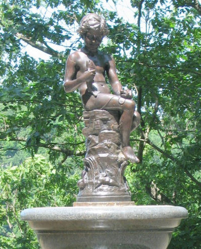 Located next to the scenic overlook on the park access
road. The statue has been at the park for over 100 years and
was recently refurbished. It was originally used as a
watering trough for horses.
Located next to the scenic overlook on the park access
road. The statue has been at the park for over 100 years and
was recently refurbished. It was originally used as a
watering trough for horses.
-
Attributes: HISTORY - Over
100 year old statue. SPECIMEN - Good example of era
statuary.
Pootatuck Fort Hill Marker and Picnic Area
 The area above the park was once the site of a Pootatuck
Indian fort, now commemorated with an engraved boulder and
picnic tables at the southeast end of Riverview Park, with
seasonal views of the river. The engraving reads:
The area above the park was once the site of a Pootatuck
Indian fort, now commemorated with an engraved boulder and
picnic tables at the southeast end of Riverview Park, with
seasonal views of the river. The engraving reads:
"Fort Hill. On this point of land the Pootatuck Indians built a Fort in 1673 to prevent the white man from coming up the Ousatonic River." The stone was prepared by The Daughters of the American Revolution.
-
Attributes: VIEW - Partly
obstructed seasonal view of the river. HISTORY -
Historic marker. PARK PUBLIC RECREATION - Picnicking
Constitution Oak
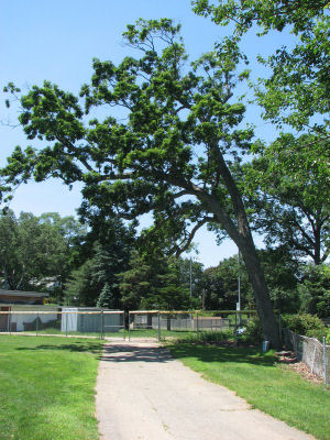 The Constitution Oak is located at the back of the
southeast (large) baseball field and is marked with a plaque
which reads:
The Constitution Oak is located at the back of the
southeast (large) baseball field and is marked with a plaque
which reads:
"This is a Constitution Oak presented to Riverview Park 1902 by Senator Sturges Whitlock, Delegate to the Constitutional Convention. This marker placed 1934 by the Kiwanis Club of Shelton."
Constitution Oaks are direct descendents of the Connecticut Charter Oak, which blew over in a storm in the late 1800's.
-
Attributes: SPECIMEN
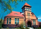
War Memorial Building and Surroundings
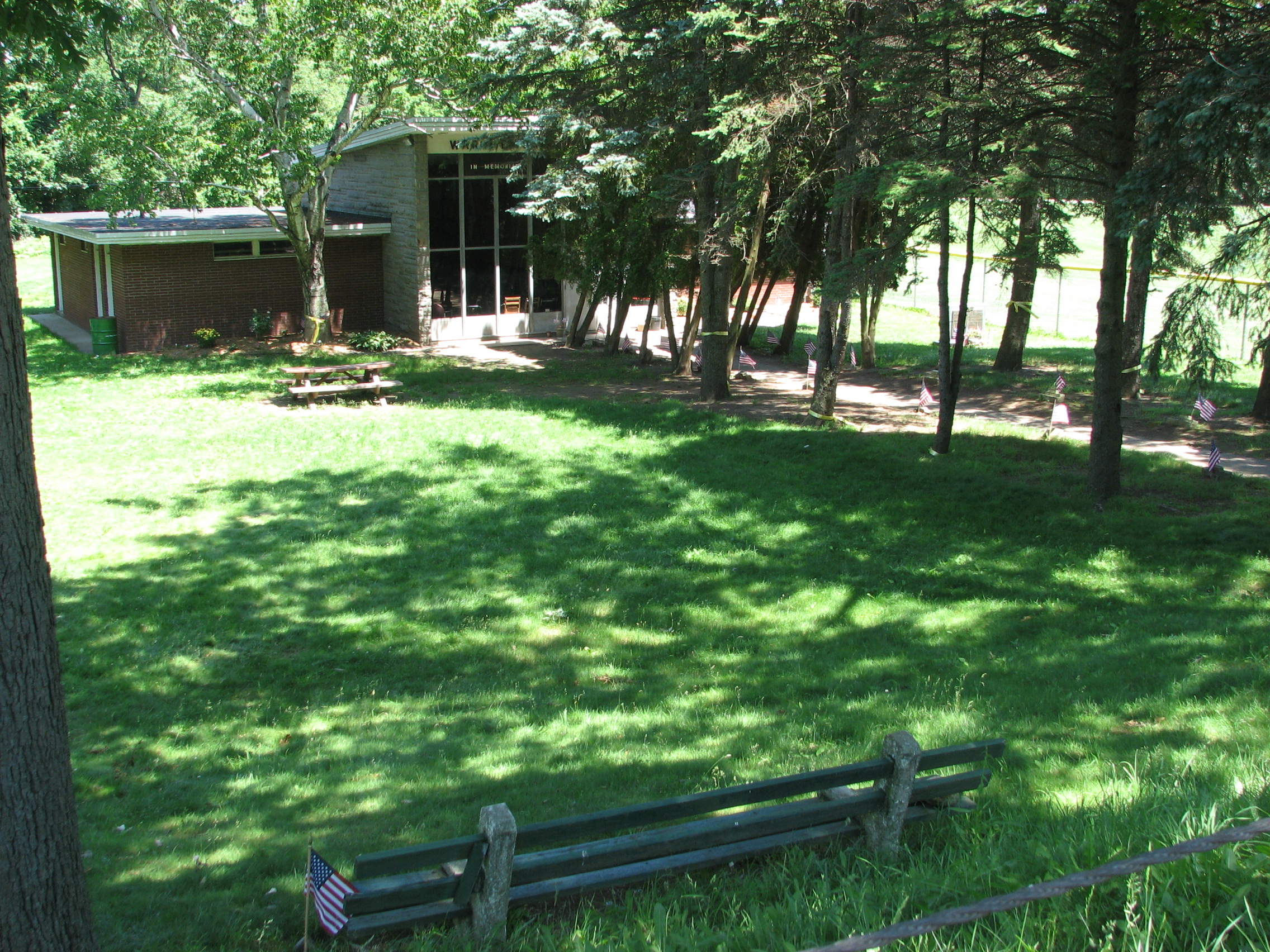 The War Memorial Building is located between the
two ball fields. A walkway leading from Howe Avenue to
the War Memorial is lined with memorials and flags, a
picnic table and a park bench. The largest memorial is
for the men and women from Shelton who died serving in
WWI, WWII and the Korean War.
The War Memorial Building is located between the
two ball fields. A walkway leading from Howe Avenue to
the War Memorial is lined with memorials and flags, a
picnic table and a park bench. The largest memorial is
for the men and women from Shelton who died serving in
WWI, WWII and the Korean War.
-
Attributes: HISTORY
CCC-Built Structures and Trails
A hiking trail and bridge reportedly built as a depression-era CCC project follows the forested riverbank. There are partly obstructed river views when the trees are dormant. Attributes: VIEW - partly obstructed views of river off-season
-
HISTORY - CCC project PUBLIC RECREATION - hiking
City Historic Marker
 In 1976 the state's Historical Commission gave identical cast-aluminum and enamel historic markers to each city in the state to mark the nation's bicentennial. Shelton's marker is located along Howe Avenue near the ballfields.
-
Attributes: HISTORY
Yale Boat House Vista
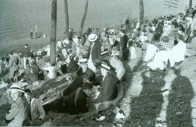 The Riverview hillside opposite the Yale Boathouse (located in Derby just north of the dam) once provided a popular vantage point of the rowing races (see historic photo). The bank is now heavily forested, providing only limited views after the trees have lost their leaves. A substantial hiking trail cuts along the hillside. Judicial pruning might renew the vista. However, care must be taken not to spoil the view of the wooded slope as seen from the river, or to cause erosion of the vulnerable hillside.