Conservation Commission
Shelton, Connecticut

CRI MENU
- CRI Home
- Scenic Resources
- Historic Resources
- Ecological Resources
- Agricultural Resources
- Water Resources
Connecticut CRI Data for Shelton
 SCENIC
RESOURCES
MENU:
- Scenic - Home
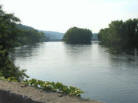
- Housatonic River
- Water Resources (Other)
- White Hills Agriculture
- Agricultural (Other)
- Riverview Park
- Scenic Roads
- Downtown Shelton
- Other
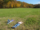
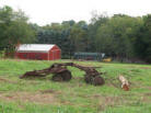 White Hills Agriculture
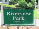 Riverview Park
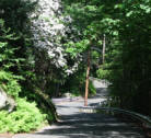 Scenic Roads
Water Resources (Other)
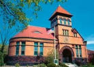
Downtown Shelton
 Agriculture (Other)
Other - Scenic Resources Inventory
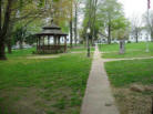
Huntington Green
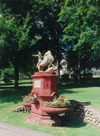 "Huntington Green" includes the actual Green (including the Curtiss Memorial Fountain
and gazebo), as well as the surrounding churches, fire house and old
cemetery.
"Huntington Green" includes the actual Green (including the Curtiss Memorial Fountain
and gazebo), as well as the surrounding churches, fire house and old
cemetery.
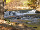
Shelton Lakes Recreation Path
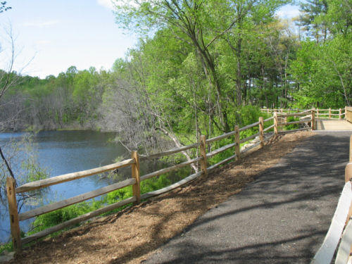 The multi-use Rec Path begins at Pine Lake on Shelton Avenue, near Meadow
Street, and winds through the Shelton Lakes Greenway for nearly five miles
before ending in Huntington Center. The path passes all three of the
Shelton lakes, scenic and history dams and gatehouses, streams (including
Means and Curtiss Brooks, interesting rock features, and a meadow.
The multi-use Rec Path begins at Pine Lake on Shelton Avenue, near Meadow
Street, and winds through the Shelton Lakes Greenway for nearly five miles
before ending in Huntington Center. The path passes all three of the
Shelton lakes, scenic and history dams and gatehouses, streams (including
Means and Curtiss Brooks, interesting rock features, and a meadow.
Streetscapes
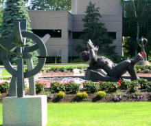 Examples of streetscapes include landscaping and sculptures along
Bridgeport Avenue and corporate offices such as the sculptures at the
Enterprise Towers (pictured), which includes a reproduction of the Statue
of David.
Examples of streetscapes include landscaping and sculptures along
Bridgeport Avenue and corporate offices such as the sculptures at the
Enterprise Towers (pictured), which includes a reproduction of the Statue
of David.
Stone Walls
This category includes old New England stone walls such as those found along Long Hill Avenue, Soundview Avenue, Birdseye Road and Walnut Tree Hill Road. Stone walls may be vulnerable to development and may be harvested (legally or illegally) for commercial rock.
Attributes: VIEW HISTORIC - Colonial New England. FEATUREHistoric Roadbeds
 Old colonial roadbeds not used as city streets include:
- Oak Valley, from the existing Oak Valley Road to Shelton Avenue, now used as a hiking trail called Oak Valley Trail.
- Old Coram Road, from the Waterview Landing development off of Warwick Road to Nature Lane.
- Old Kings Highway, from Mill Street north towards Buddington Road, and from Buddington Road north to John Dominick Drive and beyond, now used as a hiking trail (Dominick and Nells Rock Trails).
- Old Farm Road, from Indian Well/Burritts Ground Road north, and an unnamed road from Old Farm Road west.
The roadbeds are typically lined with stone walls, with sunken treadways and occasional stone culverts.
Attributes: VIEW HISTORIC - Colonial era, possibly old Indian roads as well. PASSIVE RECREATION - Hiking. FEATURES - Stone walls, stone culverts, old roadbed. AT RISK - Potential development as well as damage from off-road vehicles.