Conservation Commission
Shelton, Connecticut
Our Blogs & Groups:
- Trails Committee Blog
- Eklund Garden Page
- Eklund Garden Blog
- CC Google Group
- Deer Committee Blog
- Litter Committee Blog
- "In the Field" Blog
- Facebook Page

Shelton Land Trust
The Shelton Land Conservation Trust is a private organization often confused with the Conservation Commission. The Land Trust owns 364 acres of private open space that is open to the public, including several trails and a youth camp.
Links
- Shelton Land Trust
- City of Shelton
- Litter Committee
- Ansonia Nature Ctr
- CT Forest & Parks
- Housatonic Valley
Contact
Teresa Gallagher
Natural Resource Manager
(203) 924-1555 x1315
City of Shelton
54 Hill Street
Shelton, CT 06484
(email)
Natural Resource Manager Teresa Gallagher's office is located in Room 102 of City Hall (adjacent to the auditorium). If you need to meet with her, please call first to make sure she will be at her desk.

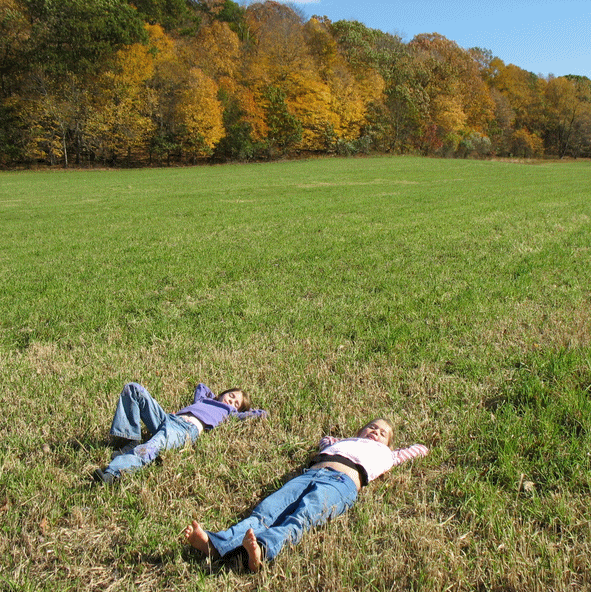

Outdoor Recreation
Opportunities for outdoor pursuits abound in Shelton. In addition to nearly 2000 acres of city-owned public open space, there are Land Trust properties, Indian Well State Park, the Housatonic River, pick-your-own activities at our local farms, and historic sites such as the Shelton Canal and Locks.
Below are some of the activities we are most commonly asked about. Please note that ball fields, concert series, fireworks, playgrounds, and other forms of active recreation are under the purview of the Parks & Rec Department and not addressed on this page.
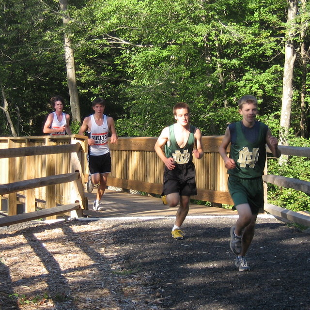
Shelton Trails - Hiking, Walking, Wheelchairs, Baby Strollers
There are over 15 miles of walking paths in Shelton, 10 miles in the Shelton Lakes Greenway alone. We have a tiered system of trails and paths to appeal to all abilities:
- Multi-Use, Handicapped-Accessible Path
(Shelton Riverwalk,
Shelton Lakes Recreation Path).
These paths are very wide and suitable for baby strollers,
bikes, and wheelchairs, similar to a Rails-to-Trails path.
By Summer 2011, 3.5 miles of the 4-mile Rec Path should be
complete.
- Easy Hiking Trails.
Oak Valley, Nell's
Rock, Dominick, Turkey Trot,
Gristmill,
Boehm Pond,
Riverview, and
Nicholdale Farm trails are all fairly easy
hiking trails. The ground is uneven in places and you
do need to be able to follow trail blazes and should carry a
trail map.
- Challenging Hiking Trails. The Paugussett ("Blue Dot"), Birchbank Mtn, and Tahmore Loop Trails are more difficult due to steep slopes and tricky footing in places. These trails are all located along the steep bank of the Housatonic River.
More information about our trails, including trail maps, driving directions, mileage, and a tutorial on how to read trail blazes is found at the Trails webpage.
Gardening
See the Gardening/Farm page for more information about the community and public gardens in Shelton
The City runs an "Adopt-A-Spot" program where residents can plant flowers or shrubs in a public place, typically a street corner or center island. Forms are available in City Hall or by calling Marilynn Gannon at City Hall, 924-1555. There is also a gardening group called the Old Ripton Garden Club.Dogs
The Shelton Dog Park was constructed in 2010 by Parks & Rec on Nells Rock Road next to Shelton Avenue (Rt. 108). There is a fenced-in area for large dogs and another for small dogs. The dog park is adjacent to the 11-mile network of hiking trails, including the multi-use Shelton Lakes Recreation Path. To help out with the Friends of the Shelton Dog Park Committee, please complete an online form here.
Dogs on leash are welcome on all hiking trails in Shelton. Please note that coyotes represent a hazard to off-leash dogs, and reports have been received of some particularly bold coyotes in the Nells Rock Road hiking trails following off-leash dogs. Use caution! Coyotes have reportedly waited for small dogs to be let outside their homes, at which point they become easy prey. House cats can also become coyote prey. Coyotes have very large home ranges and may be found throughout Shelton.
Biking
Families are often looking for easy places to bike where they
are not exposed to traffic. The
Shelton Lakes
Recreation Path (or "Rec Path") is a crushed stone
path 8-12 feet wide. By Summer 2011, 3.5 miles of the 4-mile
path should be complete, leaving a half-mile section in the
center not built. Access points include Pine Lake on
Shelton Ave and the Dog Park on Nells Rock Road at Shelton Ave.
Parking for the Huntington Center end of the Path is at the
Community Center. The actual path begins off of Lane
Street.
Other options in the region include the
Derby Greenway (Derby),
Pequonnock River Greenway (Trumbull), and the
Housatonic Rail-Trail (Monroe).
Mountain bikes are popular in the Shelton Lakes Greenway, where there is a 10-mile network of trails. Advanced mountain bikers typically rank these trails as easy, while beginners may find them difficult. Mountain bikes are prohibited from CFPA's Blue-Blazed Trail system (Paugussett Trail, Tahmore Trail, and associated connector trails at Indian Well and Birchbank Mountain). They are also prohibited at French's Hill, Birchbank Mountain, and Housatonic Woods due to the sensitive trail conditions along the slopes of the Housatonic River. Under Shelton's Open Space regulations, mountain bikes are restricted to "designated trails." These are trails designated by the Trails Committee as being open for mountain biking.
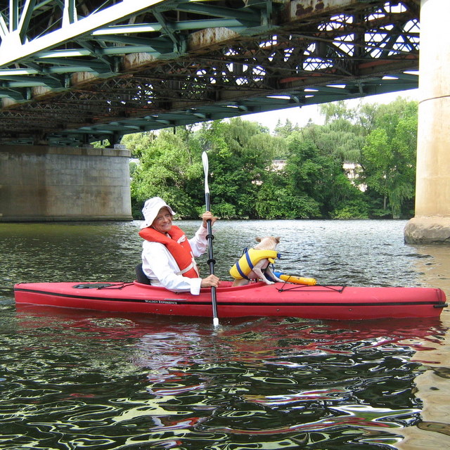
Fishing and Boating
Canoe and fishing is allowed on all Shelton waterways except those managed by the Aquarion water company (Trap Falls, Means Brook, and Isinglass Reservoirs). Motorized boats frequent the Housatonic River. Check with the CT DEP for licensing requirements.
The Housatonic River is tidal to the
Ousatonic Dam and fishing enthusiasts have reported abundant
bluefish and striped bass. North of the dam, Lake Housatonic
fishing is classified by the DEP as “good” for yellow perch and
American eels, and fair for other species such as bass, crappie,
and sunfish. There is a PCB advisory for some types of fish
caught in the Housatonic River, due to historic discharges from
General Electric in Massachusetts. The Housatonic River
north of the Merritt Parkway is classified under the Inland
Water District by the DEP even though it is tidal. This means a
fishing license is required. Boat launches are found at
Sunnyside Park (permit required via
City
Clerk),
Indian Well State Park ($), and in Derby (free) off the end
of Caroline Street. On-shore fishing and kayak/canoe access is off the north end of Canal
Street at the hydroelectric facility; behind the
Sports Center of CT;
at Sunnyside Park ($); at Indian Well State Park ($); and at South Bank
Park (near Moulthrop Lane.)
The Far Mill River is a popular trout-fishing
stream that is stocked by the Connecticut Department of
Environmental Protection each spring and fall. Native and
“holdover” trout are reported in the river, which can also
migrate up the river from the Housatonic. Suggested access
is via the Gristmill Trailhead on Mill Street. The section from Gristmill Trail
to Route 110 is also a regional attraction for advanced
kayakers, but can be very dangerous and should not be attempted
by anyone except the most skilled.
Hope Lake (a.k.a. Nell’s Rock Reservoir) is the
most popular fishing lake in Shelton. It is stocked with trout
each spring and also supports native largemouth bass and sunfish
populations. There is a handicapped-friendly fishing platform
near the dam that can also be used as a canoe/kayak put-in.
Silent Waters (a.k.a. Shelton
Reservoir #1) and Pine Lake (a.k.a. Shelton
Reservoir #2) are too shallow to stock with trout and are
limited to warm water fish species such as bass and sunfish.
Silent Waters is known to have a sizeable population of chain
pickerel. Stocking of fast-breeding warm-water species is
considered counterproductive because heavily fished lakes tend
to have an overabundance of juvenile fish, resulting in
depressed growth rates, and stocking would simply exacerbate
this situation. There is a stone canoe/kayak launch across
from the Intermediate School.
Outdoor Swimming
Outdoor swimming in Shelton is limited to Indian Well State Park, on the Housatonic River, which is known for some drop offs and current. The reservoirs at Shelton Lakes are small and do not lend themselves to the creation of public beaches. Many Sheltonites go to Short Beach in Stratford ($5 per car) or Great Hollow Lake in Wolfe Park, Monroe (off-season or with a membership only). A suggested alternative is Black Rock State Park ($7 per car includes beach and hiking, about 30 minutes from Shelton just off Route 8 in Watertown).
Agricultural Activities
You can pick your own crops at Jones Family Farm (strawberries, blueberries, pumpkins, and Christmas trees); Beardsley Cider Mill and Orchard (apples); and Fairview Tree Farm (Christmas Trees, haunted hayrides). These farms typically have related activities and attractions to create a family-oriented fun experience.
Wells Hollow Creamery hosts outdoor birthday parties and Scouting groups. Activities include feeding the farmyard animals and touring the barn.
Several of our local farms offer shopping, and Jones Family Farm has wine tasting. Please check the following listings here.
Hunting
Hunting is strictly regulated by the CT DEP and prohibited in Shelton Public Open Space, although we are monitoring efforts by towns such as Ridgefield and Redding to reduce deer population by restricted bow hunting in open space. Residents are encouraged to call the DEP 24/7 at (860) 424-3333 if they encounter hunting on City property, with a follow-up call to the Conservation Agent (924-1555 x1315). Please be sure the property is actually city property before you call.
Most hunting in Shelton occurs on private property with the permission of the property owner, notably on farms in the White Hills where deer may cause crop damage. Shelton has purchased the development rights to 411 acres of this private farmland, protecting it from development and preserving the possibility of hunting, but has no control over whether the property owner chooses to allow hunting. Note that there are no restrictions with regard to minimum distances from buildings or property lines for bow hunters.
In 2002, the State of Connecticut purchased the development and recreation rights to a substantial amount of Aquarion watershed property in Shelton and elsewhere (hundreds of acres in Shelton alone). These lands are known collectively as Centennial Watershed State Forest. A committee composed of representatives from the DEP, Aquarion, and the Nature Conservancy determine whether hunting may be allowed on these properties. Some of the regional Centennial properties are open to hunting (mostly in Easton, Weston, and Redding), but only one property is open to hunting in Shelton. This property is located off of Sawmill City Road in the White Hills (see listing).
Geocaching and Letterboxing
There are roughly 80 hidden letterboxes and geocaches located in Shelton. These containers were hidden by individuals rather than the City of Shelton. Container hold a logbook and either a rubber stamp (letterboxes) or possibly trickets for trade (geocaches). Listings may be found at geocaching.com, letterboxing.org, and atlasquest.com. A gps device is required to find geocaches. Geocaches and letterboxes are allowed on city property as long as they do not lead to any disturbance of the environment or historical structures (such as stone walls). Geocaches should not be placed on the lower part of the Birchbank open space due to sensitive wildflower habitat.