Conservation Commission
Shelton, Connecticut

CRI MENU
- CRI Home
- Scenic Resources
- Historic Resources
- Ecological Resources
- Agricultural Resources
- Water Resources
Connecticut CRI Data for Shelton
 SCENIC
RESOURCES
MENU:
- Scenic - Home
- Housatonic River
- Water Resources (Other)
- White Hills Agriculture
- Agricultural (Other)
- Riverview Park
- Scenic Roads
- Downtown Shelton
- Other
 White Hills Agriculture
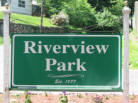 Riverview Park
 Scenic Roads
Water Resources (Other)
Downtown Shelton
 Agriculture (Other)
Water Resources (Other) - Scenic Resources Inventory
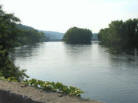
When Sheltonites are asked to name scenic places in their town, chances are good that water will be involved, whether it be a reservoir, waterfall, or river. The Housatonic River is addressed in a separate category.
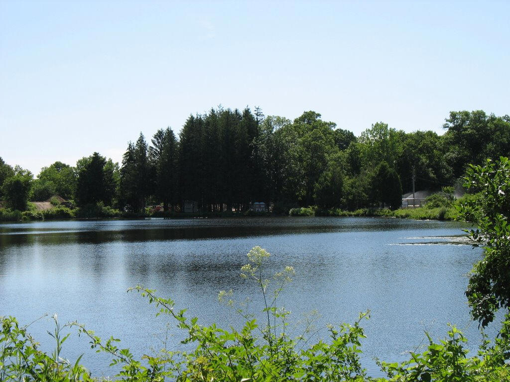
Shelton Lakes Area (Hope Lake, Pine Lake and Silent Waters)
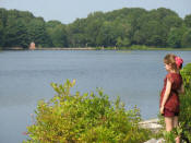 "Shelton Lakes" refers to three reservoirs located along Shelton Avenue
and Nells Rock Road formerly named Shelton Reservoirs #1 (Silent Waters),
#2 (Pine Lake) and #3 (Hope Lake). The City purchased the reservoirs and
surrounding lands in 1998 from the Bridgeport Hydraulic Company as open
space.
"Shelton Lakes" refers to three reservoirs located along Shelton Avenue
and Nells Rock Road formerly named Shelton Reservoirs #1 (Silent Waters),
#2 (Pine Lake) and #3 (Hope Lake). The City purchased the reservoirs and
surrounding lands in 1998 from the Bridgeport Hydraulic Company as open
space.
The reservoirs are used for fishing, canoeing, picnicking, and hiking along the shoreline. The associated dams were constructed in the late 1800s, and two gatehouses remain. The Silent Waters dam is a particularly impressive and unusual structure due to it's length (nearly 1/3 mile) and historic breach in 1903 which flooded downtown Shelton. See www.sheltontrails.org for a trail map of the Shelton Lakes Greenway.
Attributes: VIEWS. HISTORIC - Dams and reservoirs from the 1800s. PARK. PASSIVE RECREATION - Hiking, fishing, picnicking SPECIMEN - ??? FEATURES - Dams, Gatehouses AT RISK - Silt build up.Aquarion Reservoirs (Trap Falls, Isinglass)
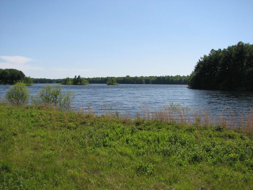 Trap Falls Reservoir is an active distribution reservoir and the largest
reservoir in Shelton. Although it is off-limits to the public and
surrounded by fencing, it is commonly viewed from Huntington Street by
passerbys and there is ample room for motorists to pull over and park.
Motorists often catch the sun setting to the west behind the reservoir and
see wildlife including herons, egrets, fox, and ospreys.
Trap Falls Reservoir is an active distribution reservoir and the largest
reservoir in Shelton. Although it is off-limits to the public and
surrounded by fencing, it is commonly viewed from Huntington Street by
passerbys and there is ample room for motorists to pull over and park.
Motorists often catch the sun setting to the west behind the reservoir and
see wildlife including herons, egrets, fox, and ospreys.
Isinglass Reservoir (aka Farmill Reservoir) can be viewed from Far Mill Street. It is accessible with a permit from the water company.
Attributes: VIEW PASSIVE RECREATION - Fishing at Isinglass Res with permit. FEATURES - Dam at Isinglass Res.Far Mill River
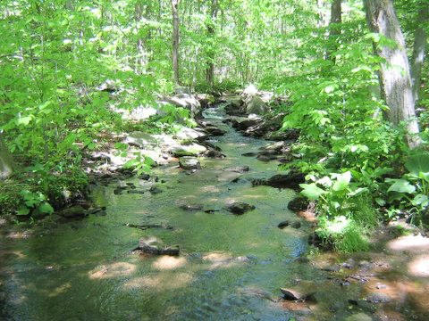
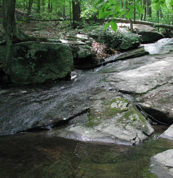
Upper Section (Mohegan Road to Means Brook)
Prior to joining Means Brook the Far Mill is a small stream alternating between falls and quiet water. Dammed, it forms Isinglass Reservoir on Far Mill Street. An impressive chute of rushing water is located off of Roaring Brook Lane. The river is too shallow to navigate by canoe or kayak here. Shortly after crossing Huntington Street near Roaring Brook Lane, the Far Mill River and Means Brook join and double in size.
Attributes: VIEW HISTORIC - ?? PASSIVE RECREATION - Fishing. SPECIMEN - ???FEATURES - Chute, falls, dam, reservoir. AT RISK water quality, sedimentation.Far Mill River
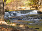
Lower Section (Means Brook to the Housatonic River)
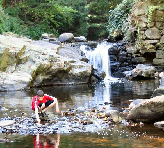 The Far Mill River has twice the volume in the lower section, due to the
addition of Means Brook. The steep drop in elevation from Mill Street to
the Housatonic River generates multiple waterfalls and rapids, and once
powered numerous mills during the colonial era. The ruins of these mills,
including what is left of dams, canals, and walls dot the shoreline. The
abutments of an old trolley line are located near River Road.
The Far Mill River has twice the volume in the lower section, due to the
addition of Means Brook. The steep drop in elevation from Mill Street to
the Housatonic River generates multiple waterfalls and rapids, and once
powered numerous mills during the colonial era. The ruins of these mills,
including what is left of dams, canals, and walls dot the shoreline. The
abutments of an old trolley line are located near River Road.
South of Farmill Crossing and Well's Hollow, the river enters into a steep gorge. The river rapids are classified as Class IV by advanced kayakers. The river is stocked with trout twice a year and popular with fishermen.
Public access points include Gristmill Trail on Mill Street and Wells Spring Open Space off Farmill Crossing. A particularly scenic area near Pine Rock Park known as "the swimming hole" is located within Stratford's Far Mill River Park, although the northern side of the river is located with the City of Shelton. Parking and access is somewhat limited. Trail maps may be downloaded at www.sheltontrails.org.
Attributes: VIEW HISTORIC - Old mills. PASSIVE RECREATION - Fishing, hiking, picnicking. SPECIMEN - ??? FEATURES - Waterfalls, old mill ruins, "Suckers Hole" boulder field, trolley bridge remains. AT RISK - Water quality; undeveloped or underdeveloped properties along the shoreline.Ivy Brook
 This small stream runs unseen along Constitution Blvd South. The steep
ravine it is located within shields the stream somewhat from the
neighboring residential and industrial developments and roads. Waterfalls
and ruins mark the stream.
This small stream runs unseen along Constitution Blvd South. The steep
ravine it is located within shields the stream somewhat from the
neighboring residential and industrial developments and roads. Waterfalls
and ruins mark the stream.
Emerson Lake
 This pond is located off of Leavenworth Road near the Monroe border, next
to a go cart track at Shelton Family Farm. The City purchased the
development rights to the pond and the surrounding farmland, although it
remains private.
This pond is located off of Leavenworth Road near the Monroe border, next
to a go cart track at Shelton Family Farm. The City purchased the
development rights to the pond and the surrounding farmland, although it
remains private.
Means Brook Reservoir
 This active drinking water reservoir is located alongside Sawmill City
Road in the White Hills and is closed to the public. Water from the
reservoir is pumped to Trap Fall Reservoir for distribution to water
users.
This active drinking water reservoir is located alongside Sawmill City
Road in the White Hills and is closed to the public. Water from the
reservoir is pumped to Trap Fall Reservoir for distribution to water
users.
Cranberry Pond and Bog
The City's only cranberry bog is located on the Stratford border off of Armstrong Road. Need more info - this item will be addressed further under ecological resources.
Attributes: VIEW. AGRICULTURE - Historic cultivation of cranberries. FEATURE - Cranberry bog.Upper White Hills Brook
 This small stream drops dramatically in a series of waterfalls and chutes
and it descends down the bank of the Housatonic River. The brook is
located within the Birchbank open space and is viewed from Paugussett and
Birchbank trails.
This small stream drops dramatically in a series of waterfalls and chutes
and it descends down the bank of the Housatonic River. The brook is
located within the Birchbank open space and is viewed from Paugussett and
Birchbank trails.