Conservation Commission
Shelton, Connecticut

CRI MENU
- CRI Home
- Scenic Resources
- Historic Resources
- Ecological Resources
- Agricultural Resources
- Water Resources
Connecticut CRI Data for Shelton
 SCENIC
RESOURCES
MENU:
- Scenic - Home
- Housatonic River
- Water Resources (Other)
- White Hills Agriculture
- Agricultural (Other)
- Riverview Park
- Scenic Roads
- Downtown Shelton
- Other
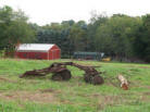 White Hills Agriculture
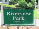 Riverview Park
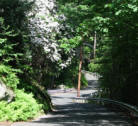 Scenic Roads
Water Resources (Other)

Downtown Shelton
 Agriculture (Other)
Housatonic River - Scenic Resources
The scenic Housatonic River is an integral part of Shelton's history and identity. Here are some of the scenic elements or notable features that make it so:
Housatonic River Shoreline
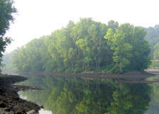
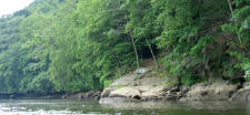 Shelton has more than eleven miles of Housatonic River shoreline, much
of which appears forested as viewed from the water, even in densely
populated areas. This category includes both the immediate shoreline and
the slopes and ridges as viewed from the water.
Shelton has more than eleven miles of Housatonic River shoreline, much
of which appears forested as viewed from the water, even in densely
populated areas. This category includes both the immediate shoreline and
the slopes and ridges as viewed from the water.
Canal, Gate House & Locks
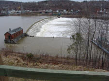 The Ousatonic Dam was built to fill the Shelton Canal with water to
power factories in the late 1800s. The dam complex, including the
gatehouse, remaining locks, and a portion of the canal, is one of the
most recognized scenic features in the City. The dam is used for energy
generation under
The Ousatonic Dam was built to fill the Shelton Canal with water to
power factories in the late 1800s. The dam complex, including the
gatehouse, remaining locks, and a portion of the canal, is one of the
most recognized scenic features in the City. The dam is used for energy
generation under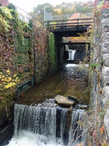 a federal license and is open to the public under a
lease by the CT Department of Environmental Protection.
a federal license and is open to the public under a
lease by the CT Department of Environmental Protection.
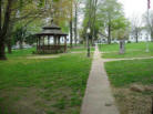
River Walk (0.3 mi.)
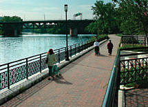 The Shelton River Walk is located in downtown Shelton along the
Housatonic River and Veteran's Park. The existing path will be extended
to the northwest as part of the downtown redevelopment project.
The Shelton River Walk is located in downtown Shelton along the
Housatonic River and Veteran's Park. The existing path will be extended
to the northwest as part of the downtown redevelopment project.
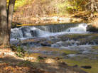
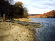
Indian Well State Park (157 acres)
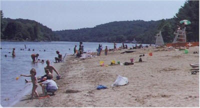 This state park is a regional attraction with a beach, boat launch,
pavilions, picnic grounds, restrooms, hiking trails, and a waterfall.
The fieldstone bridge and retaining walls located on Indian Well Road
were Works Progress Administration (WPA) projects built during the
depression,
This state park is a regional attraction with a beach, boat launch,
pavilions, picnic grounds, restrooms, hiking trails, and a waterfall.
The fieldstone bridge and retaining walls located on Indian Well Road
were Works Progress Administration (WPA) projects built during the
depression,
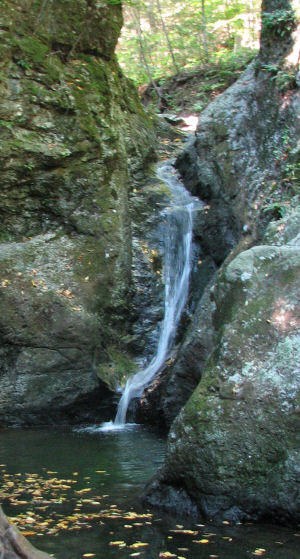 while the Paugussett "Blue Dot" Trail was created by the
Civilian Conservation Corps (CCC). The waterfall is known as the "Indian
Well", the setting of an Indian story similar to Romeo and Juliet. See
DEP webpage.
while the Paugussett "Blue Dot" Trail was created by the
Civilian Conservation Corps (CCC). The waterfall is known as the "Indian
Well", the setting of an Indian story similar to Romeo and Juliet. See
DEP webpage.
Southbank Park (2 acres)
 Southbank Park, located on Rt 110 River
Road opposite Moulthrop Lane, offer scenic views of the Housatonic River.
Southbank Park, located on Rt 110 River
Road opposite Moulthrop Lane, offer scenic views of the Housatonic River.
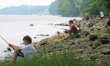
Sunnyside Boat Launch Area
 The 14-acre Sunnyside Open Space, located behind Sunnyside School on
River Road, include ballfields, a boat launch, and over 1000 feet of
shoreline for fishing or picnicking.
The 14-acre Sunnyside Open Space, located behind Sunnyside School on
River Road, include ballfields, a boat launch, and over 1000 feet of
shoreline for fishing or picnicking.
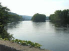
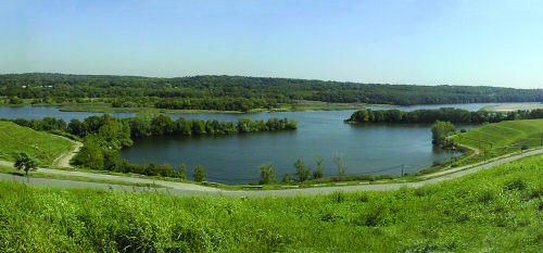
Housatonic River Islands
 There are only two true islands located partly within Shelton city
limits, both found immediately downstream from the Derby-Shelton dam
(photo). The northern island is known as Duck Island.
There are only two true islands located partly within Shelton city
limits, both found immediately downstream from the Derby-Shelton dam
(photo). The northern island is known as Duck Island.
Two Mile Island is technically a peninsula and is currently quarried for sand and gravel, although the banks are mostly vegetated and remain scenic from the river. Wooster Island and Great Flat Island are located off the Shelton shore but are located in Orange and Milford, respectively.
Attributes: VIEW - Valued as scenic and as scenic viewpoints from which to view the river. RECREATION: Popular with boaters. FEATURES: Islands are considered features.Lagoon Behind CRRA Landfill
Currently accessible only by boat, the CRRA Lagoon will be accessible to the public after closure is completed via trails and a canoe launch. See the CRRA Closure Plan.
Attributes: VIEW, FEATURE, SPECIMEN - Boaters have reported frequent sightings of Bald Eagles and other forms of wildlife in the lagoon.
Indian Head Rock
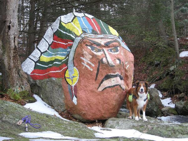 This rock is located on the shoreline at the Monroe border, and is used
by boaters as a warning of rapids further upriver. It is now located on
a very small piece of open space.
This rock is located on the shoreline at the Monroe border, and is used
by boaters as a warning of rapids further upriver. It is now located on
a very small piece of open space.