Conservation Commission
Shelton, Connecticut
 OPEN
SPACE MENU
OPEN
SPACE MENU
Open Space Links
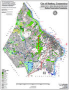
Open Space Map (3mb)
City of Shelton Open Space Marker

This marker is used to identify Public Open Space owned by the City of Shelton. It does not mark the exact location of the property line and may be as much as 100 feet away from the boundary, depending on site conditions. The Conservation and Pedestrian Easements markers have a similar look but different text.
Land Trust Marker

The Land Trust is a private, non-profit group that owns 364 acres of open space in Shelton, marked with these signs. People frequently confuse the Land Trust with the City of Shelton.
Wetlands Marker
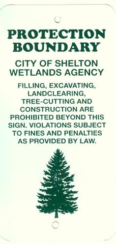
These rectangular wetlands marker may be found in some newer subdivisions, usually on 4x4 posts. They mark the location of areas regulated by the Shelton Inland Wetlands Commission. These are generally on private property and are not related to open space.
Open Space Properties #80
80.01 "Summerfield Gardens"; 80.02 "Wiacek Farm";
80.03 "#279 Soundview Ave"
Constitution Blvd No., Meadow Street, Soundview Ave
Images and Maps (Click to enlarge)
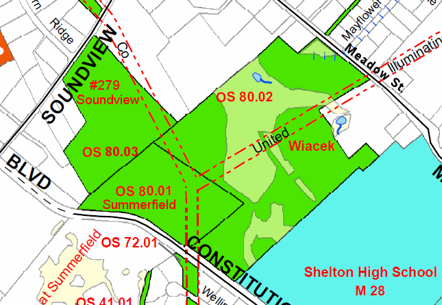
Location Map
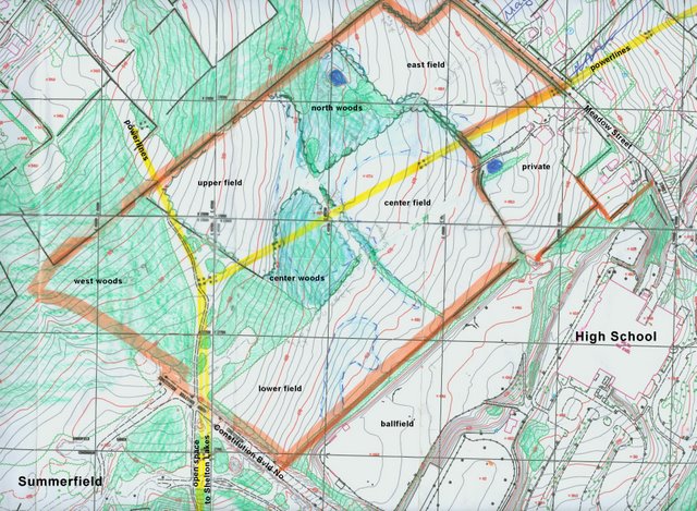
Topo for Wiacek and Summerfield parcels. The Wiacek hayfields are
divided by hedgerows and woodlands in the wetter areas.
Field north of the High School.
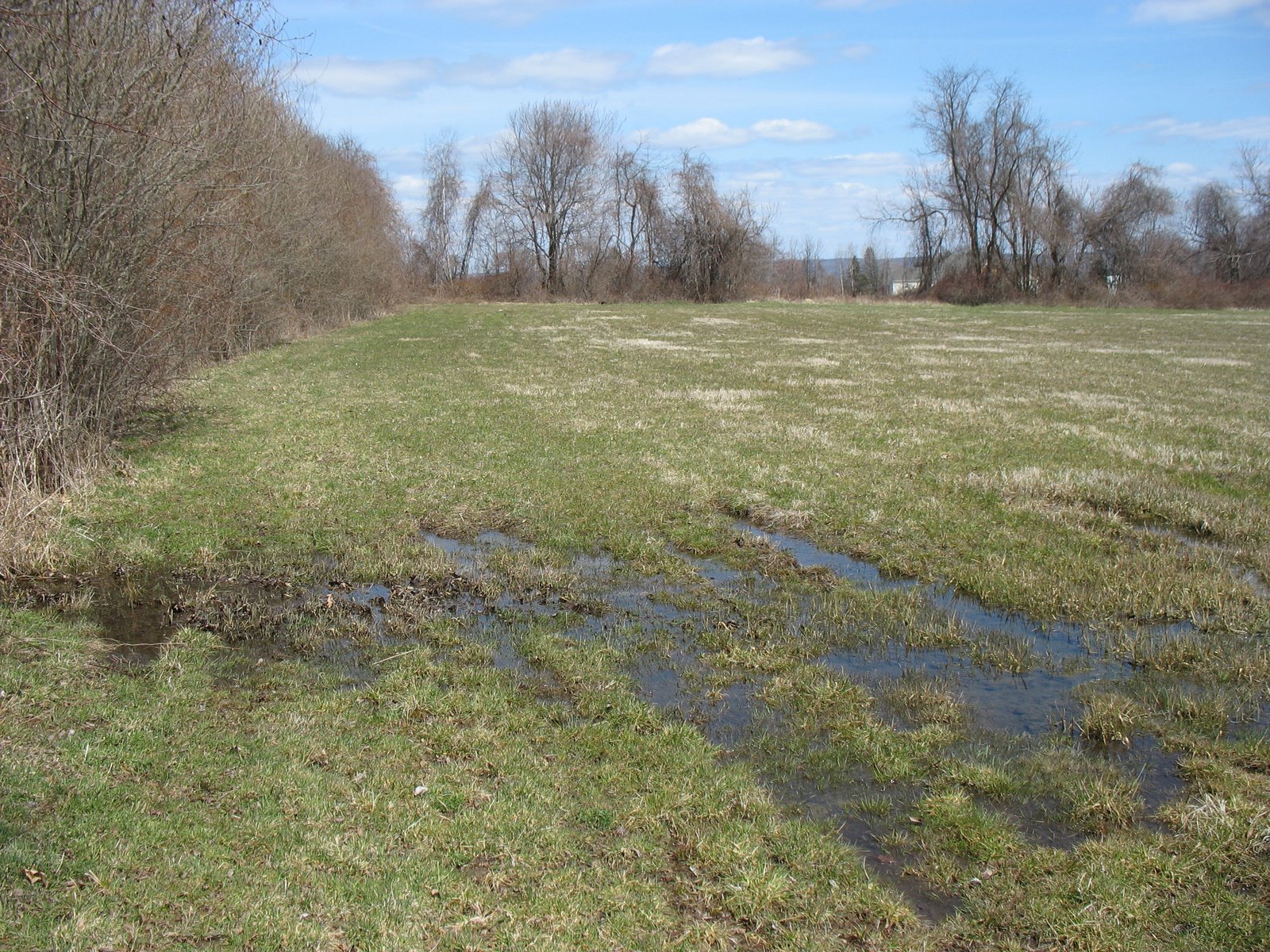
The entire Wiacek property tends to drain poorly. The fields are hayed
to local farmers by annual license.
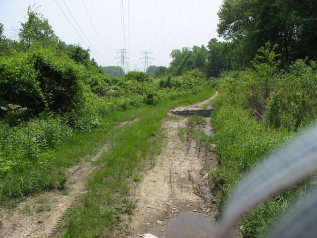
Access to the Wiacek and Summerfield properties are via this utility
road from Const. Blvd No., which can get very muddy (unauthorized
vehicles prohibited). There is no access from Meadow Street except
by climbing over a stone wall.
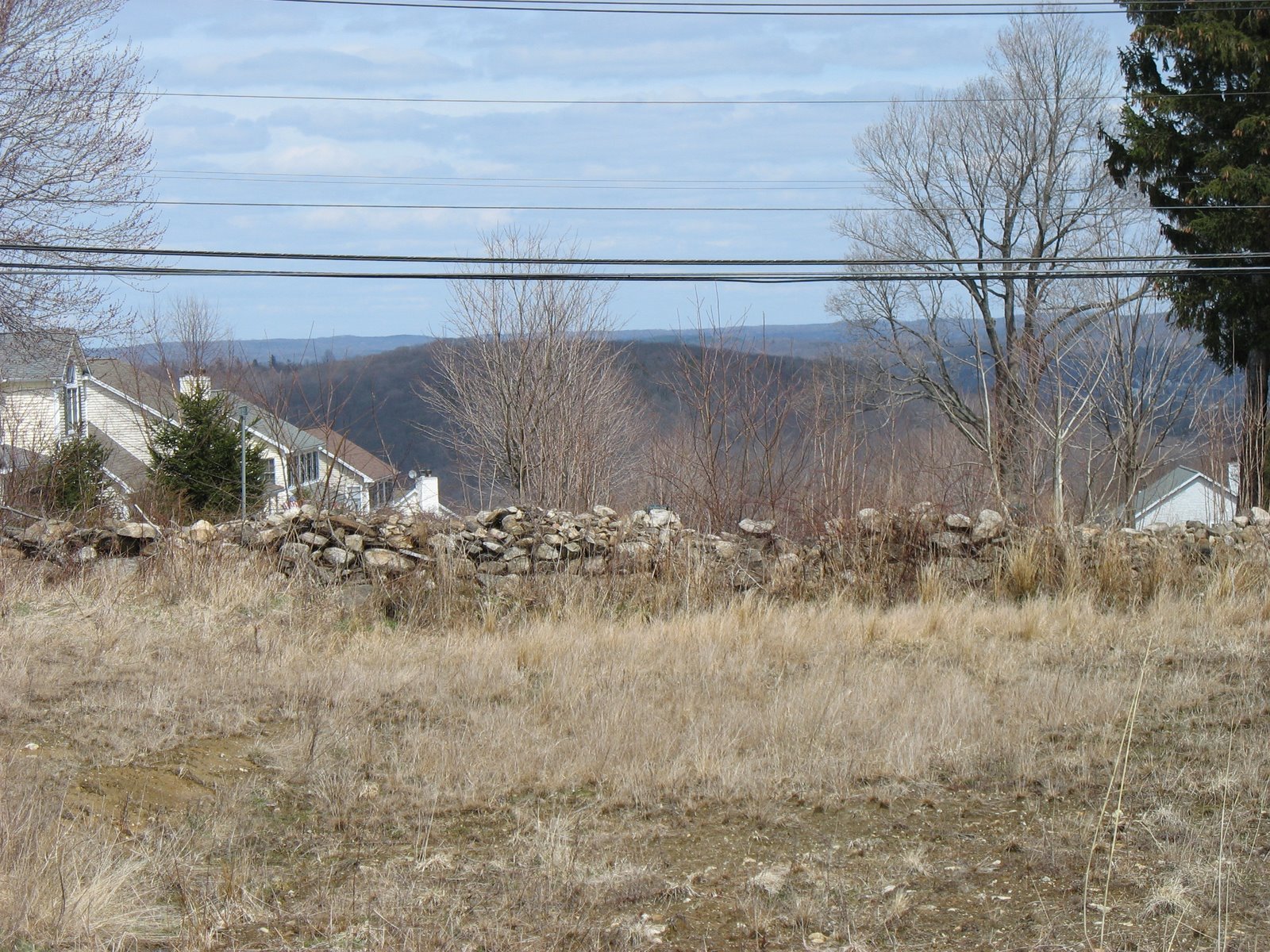
View from Wiacek property looking down Mayflower Lane to the northeast
to the Housatonic River Valley in the distance.
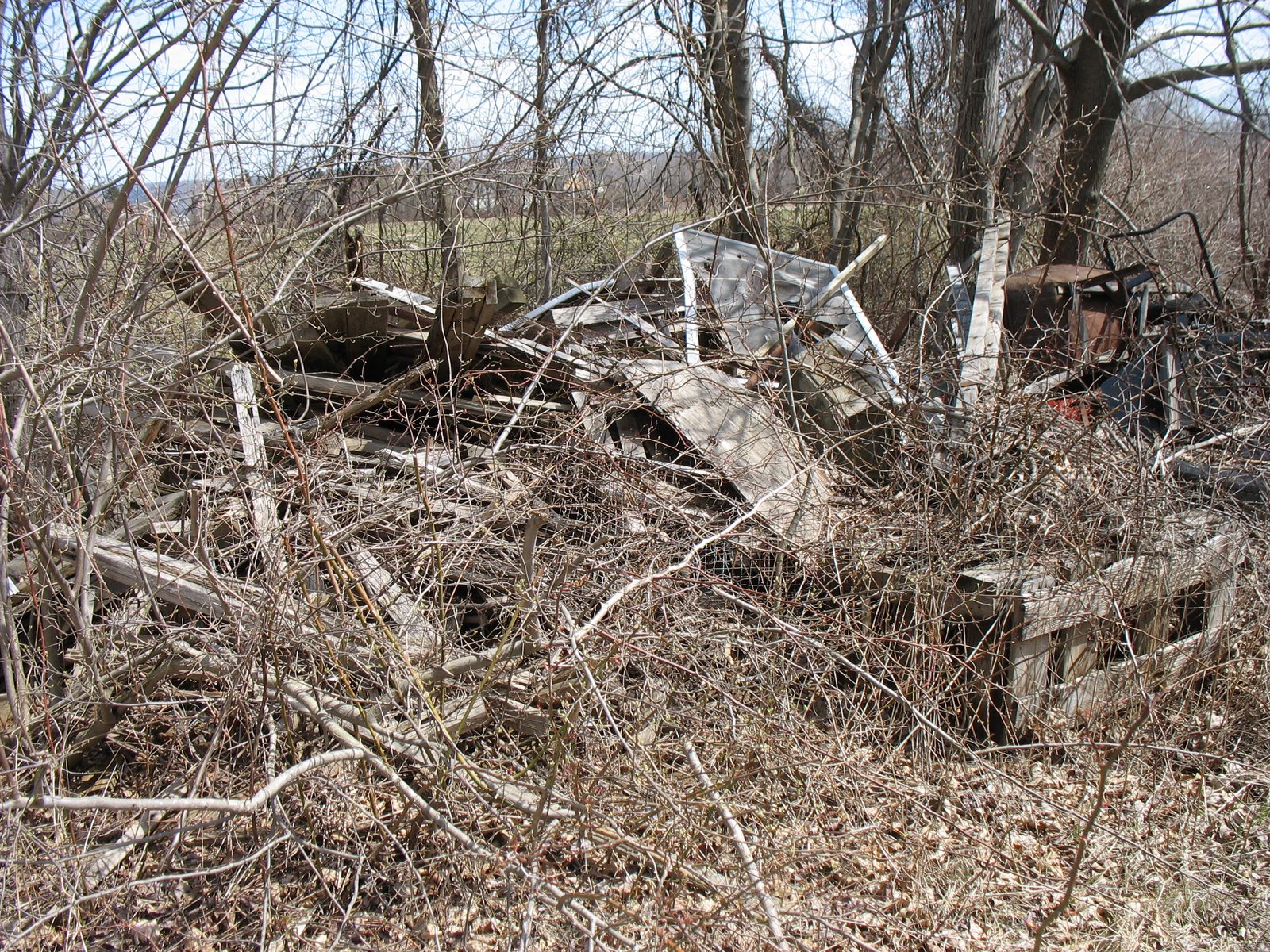
Extensive piles of farm debris were inherited when the City acquired the
property via eminent domain.
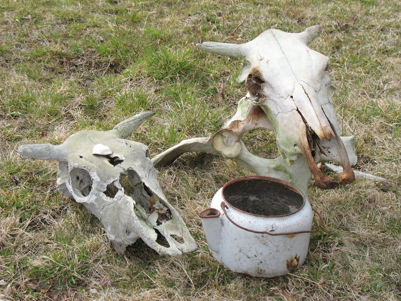
Some of the artifacts found at Wiacek.
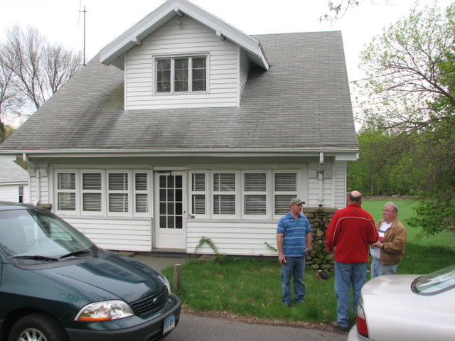
Dwelling at 279 Soundview Avenue.
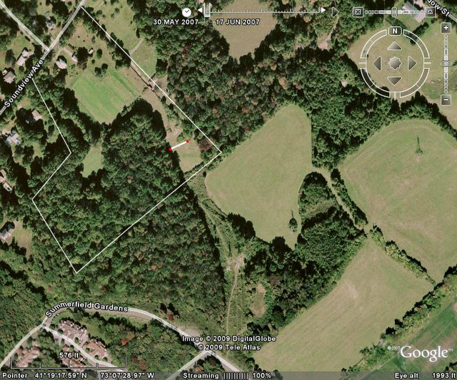
Aerial showing property line for OS#80.03 (#279 Soundview Ave.).
The Summerfield and Wiacek open space properties are to the south and
east.