Conservation Commission
Shelton, Connecticut
 OPEN
SPACE MENU
OPEN
SPACE MENU
Open Space Links
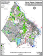
Open Space Map (3mb)
City of Shelton Open Space Marker
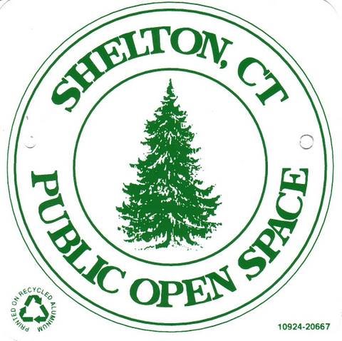
This marker is used to identify Public Open Space owned by the City of Shelton. It does not mark the exact location of the property line and may be as much as 100 feet away from the boundary, depending on site conditions. The Conservation and Pedestrian Easements markers have a similar look but different text.
Land Trust Marker

The Land Trust is a private, non-profit group that owns 364 acres of open space in Shelton, marked with these signs. People frequently confuse the Land Trust with the City of Shelton.
Wetlands Marker

These rectangular wetlands marker may be found in some newer subdivisions, usually on 4x4 posts. They mark the location of areas regulated by the Shelton Inland Wetlands Commission. These are generally on private property and are not related to open space.
Featured Open Space Properties
Access points to these properties have been added to a Google map, where you can obtain personalized driving directions.
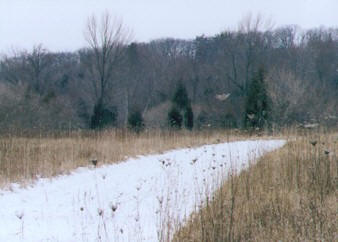
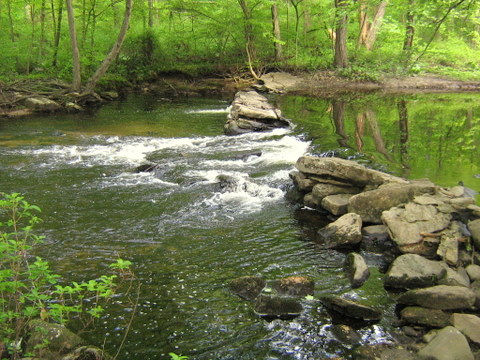
Shelton Lakes Greenway (450+ acres)
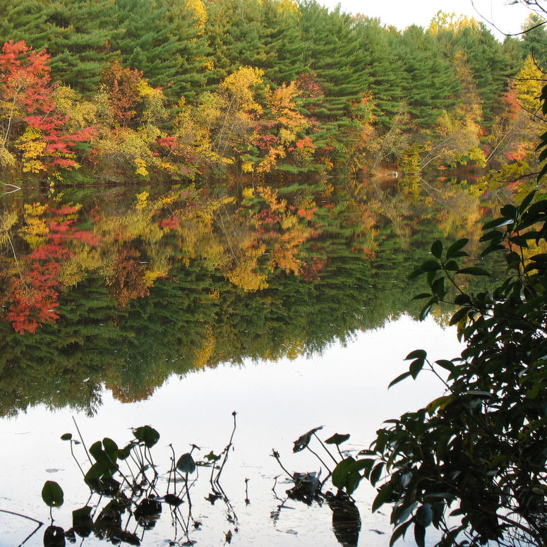 Three
reservoirs and ten miles of trails make this one of the better-known open
space areas in Shelton. Hiking, biking, canoeing, and fishing are all popular. Brochures are available at trailheads, City Hall, and the Community Center, or
download a map.
Much of the park was purchased in 1998 from Bridgeport Hydraulic Company (now Aquarion).
Three
reservoirs and ten miles of trails make this one of the better-known open
space areas in Shelton. Hiking, biking, canoeing, and fishing are all popular. Brochures are available at trailheads, City Hall, and the Community Center, or
download a map.
Much of the park was purchased in 1998 from Bridgeport Hydraulic Company (now Aquarion).
Riverview Park (32 acres)
 The oldest official park in Shelton, Riverview sits atop the Housatonic
River bluff and offers a stunning overlook of the Derby-Shelton dam as
well as a large playground, basketball courts, baseball fields, a
hiking
trail, the Veteran's Memorial building, and several historic statues
and markers. The Fort Hill inscription on a boulder marks the site
of the last Pootatuck palisade fort in Shelton, while a certified
descendent of Connecticut's Charter Oak is marked with a plaque.
The oldest official park in Shelton, Riverview sits atop the Housatonic
River bluff and offers a stunning overlook of the Derby-Shelton dam as
well as a large playground, basketball courts, baseball fields, a
hiking
trail, the Veteran's Memorial building, and several historic statues
and markers. The Fort Hill inscription on a boulder marks the site
of the last Pootatuck palisade fort in Shelton, while a certified
descendent of Connecticut's Charter Oak is marked with a plaque.
Veteran's Memorial Park, Shelton Riverwalk, and the Farmer's Market (4 acres)
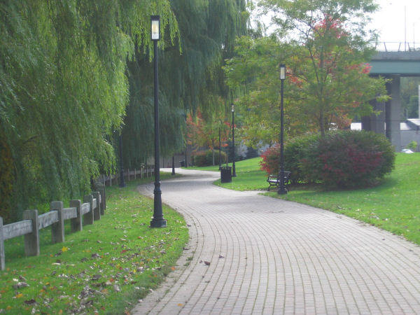 Located
in downtown Shelton overlooking the Housatonic River, this park was once
the site of a large factory that was destroyed by fire in the 1970s,
leaving nothing but the concrete floor which became dubbed "The Slab."
Today this park is home of the
Shelton Riverwalk,
the Farmer's Market, and numerous events such as 4th of July fireworks and
Shelton Day carnival rides.
Located
in downtown Shelton overlooking the Housatonic River, this park was once
the site of a large factory that was destroyed by fire in the 1970s,
leaving nothing but the concrete floor which became dubbed "The Slab."
Today this park is home of the
Shelton Riverwalk,
the Farmer's Market, and numerous events such as 4th of July fireworks and
Shelton Day carnival rides.
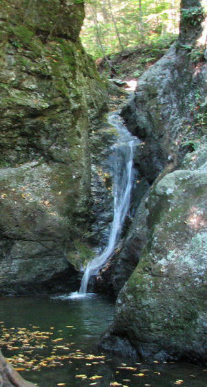
Birchbank Mountain (155 acres)
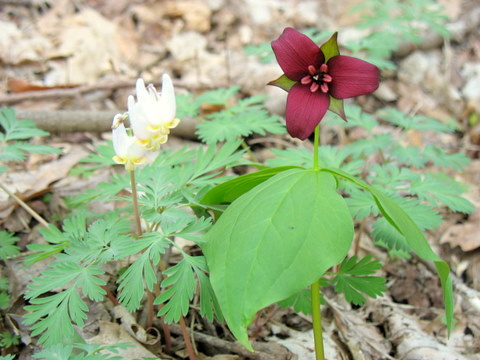 Perhaps
our most remote and rugged open space property, Birchbank Mountain is
marked with a superb display of spring wildflowers in the Housatonic River
Floodplain as well as the cascades of Upper White Hills Brook as it descends rapidly to the river below.
The park abuts Indian Well State Park and is crossed by the Paugussett ("Blue Dot") Trail and a
white-blazed loop.
Perhaps
our most remote and rugged open space property, Birchbank Mountain is
marked with a superb display of spring wildflowers in the Housatonic River
Floodplain as well as the cascades of Upper White Hills Brook as it descends rapidly to the river below.
The park abuts Indian Well State Park and is crossed by the Paugussett ("Blue Dot") Trail and a
white-blazed loop.
Nicholdale Farm (65 acres)
 This old farm is owned by the Shelton Land Conservation Trust,
who maintains several easy
loop trails and a youth camp on the property.
The Land Trust strives to preserve the old fields, which provide rich wildlife
habitat for many species that are declining in Connecticut due to the loss
of agricultural lands. A concrete underpass that crosses Rt 110 was
once used by dairy cattle to cross the road.
This old farm is owned by the Shelton Land Conservation Trust,
who maintains several easy
loop trails and a youth camp on the property.
The Land Trust strives to preserve the old fields, which provide rich wildlife
habitat for many species that are declining in Connecticut due to the loss
of agricultural lands. A concrete underpass that crosses Rt 110 was
once used by dairy cattle to cross the road.
Southbank Park (2.0 acres)
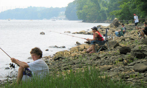 Located
along Rt 110 opposite Moulthrop Lane, Southbank Park has become a popular
destination for fishing, kayaking, and picnicking along the Housatonic
River. An old garage
overlooking the river has been modified to serve as a pavilion and benches
provide a place to rest. A suggested canoe/kayak trip is from the
Derby boat launch to Southbank Park. This part of the river is tidal.
Located
along Rt 110 opposite Moulthrop Lane, Southbank Park has become a popular
destination for fishing, kayaking, and picnicking along the Housatonic
River. An old garage
overlooking the river has been modified to serve as a pavilion and benches
provide a place to rest. A suggested canoe/kayak trip is from the
Derby boat launch to Southbank Park. This part of the river is tidal.
Boehm Pond (72 acres)
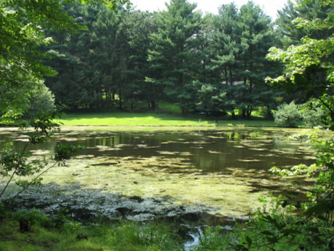 This
wooded open space features a
loop trail and spur
of about one mile in length, with tiny Boehm Pond as a destination.
The pond has bass and sunfish but may be difficult to fish during the
summer due to heavy algae. There is a large huckleberry patch on the
south end of the property.
This
wooded open space features a
loop trail and spur
of about one mile in length, with tiny Boehm Pond as a destination.
The pond has bass and sunfish but may be difficult to fish during the
summer due to heavy algae. There is a large huckleberry patch on the
south end of the property.
Gristmill Trail on the Far Mill River (32 acres)
 The scenic Far Mill River was the site of many colonial mills because the
rapid drop in elevation provided a great deal of water power along its
lower reaches. The ruins of a mill dam are a popular popular spot to fish or just enjoy the scenery from a bench. The river contains both stocked and native
trout. A short trail
follows the river shoreline along a floodplain forest that is inundated
with raging floodwaters about once a year.
The scenic Far Mill River was the site of many colonial mills because the
rapid drop in elevation provided a great deal of water power along its
lower reaches. The ruins of a mill dam are a popular popular spot to fish or just enjoy the scenery from a bench. The river contains both stocked and native
trout. A short trail
follows the river shoreline along a floodplain forest that is inundated
with raging floodwaters about once a year.
Indian Well State Park (157 acres)
 The
beach and boat launch at Indian Well State Park are regional attractions
and a fee is charged on a per-car basis to enter the beach area.
The
beach and boat launch at Indian Well State Park are regional attractions
and a fee is charged on a per-car basis to enter the beach area.
There is a separate parking area (no charge) that provides access to the beginning of the Paugussett Trail as well as the Indian Well Falls from which the park takes its name. Note that these two trails are separate (the DEP's trail map incorrectly shows the beginning of the Paugussett Trail). The heavily-used Falls Trail begins directly across the street from the parking area, while the blue-blazed Paugussett Trail begins further up the road across the stone bridge and rises steeply as it ascend the river bluff from the parking area. The Paugussett Trail continues for several miles to East Village in Monroe.
Indian Head Rock (0.1 acre)
 This tiny sliver of open space on the shore of the Housatonic River
features the landmark "Indian Head Rock," which has been painted by nearby
residents of "Wholand" for decades. Boaters use the rock to mark the end
of Lake Housatonic and the begin of upstream shallows and rapids.
There is a smooth rocky ledge where canoes and small boats may pull up and
have a picnic. Please respect neighboring property owners.
This tiny sliver of open space on the shore of the Housatonic River
features the landmark "Indian Head Rock," which has been painted by nearby
residents of "Wholand" for decades. Boaters use the rock to mark the end
of Lake Housatonic and the begin of upstream shallows and rapids.
There is a smooth rocky ledge where canoes and small boats may pull up and
have a picnic. Please respect neighboring property owners.
Shelton Canal (4 acres)
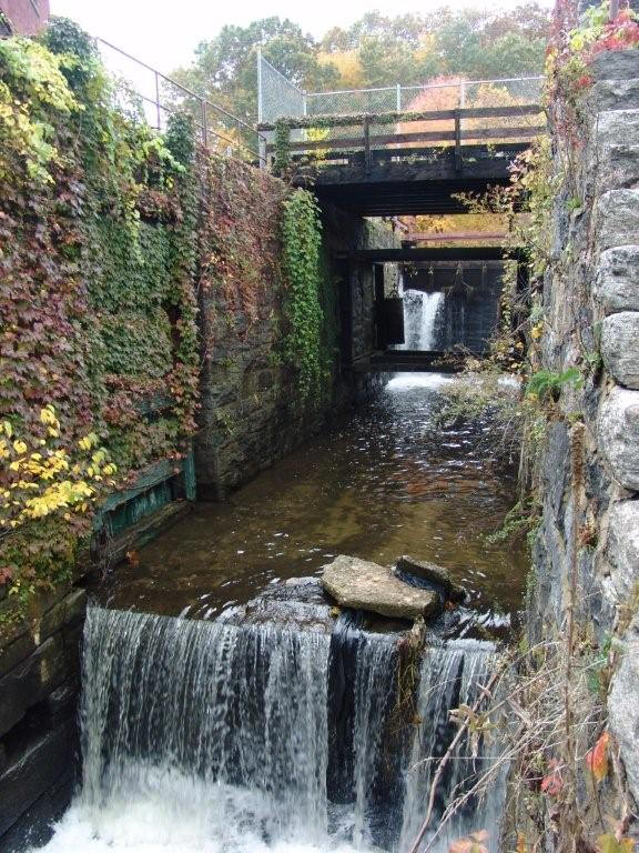 The
scenic Shelton Canal property is owned by McCallum Enterprises and open to
the public under the company's federal hydroelectric permit. The property
is located immediately downstream from the Derby-Shelton Dam and is used
by fishermen to access a fishing hotspot near the foot of the dam.
There are also picnic tables and benches along the 1000-foot long public
area. Limited parking is available at the northern terminus of Canal
Street. A bridge near the entrance carries visitors over a set of locks that were once used to
carry boats around the dam. The canal and dam complex was built to
generate power for the factories along Canal Street and lead to the rapid rise of
industrial Shelton in the late 1800s. The area is currently in
dispute (more
info...)
The
scenic Shelton Canal property is owned by McCallum Enterprises and open to
the public under the company's federal hydroelectric permit. The property
is located immediately downstream from the Derby-Shelton Dam and is used
by fishermen to access a fishing hotspot near the foot of the dam.
There are also picnic tables and benches along the 1000-foot long public
area. Limited parking is available at the northern terminus of Canal
Street. A bridge near the entrance carries visitors over a set of locks that were once used to
carry boats around the dam. The canal and dam complex was built to
generate power for the factories along Canal Street and lead to the rapid rise of
industrial Shelton in the late 1800s. The area is currently in
dispute (more
info...)