Conservation Commission
Shelton, Connecticut
 OPEN
SPACE MENU
OPEN
SPACE MENU
Open Space Links
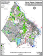
Open Space Map (3mb)
City of Shelton Open Space Marker
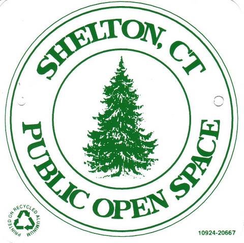
This marker is used to identify Public Open Space owned by the City of Shelton. It does not mark the exact location of the property line and may be as much as 100 feet away from the boundary, depending on site conditions. The Conservation and Pedestrian Easements markers have a similar look but different text.
Land Trust Marker

The Land Trust is a private, non-profit group that owns 364 acres of open space in Shelton, marked with these signs. People frequently confuse the Land Trust with the City of Shelton.
Wetlands Marker
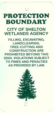
These rectangular wetlands marker may be found in some newer subdivisions, usually on 4x4 posts. They mark the location of areas regulated by the Shelton Inland Wetlands Commission. These are generally on private property and are not related to open space.
OS 4 Honeybee Lane (1.68 acres)
Tax Accessor Map 14 Lot 27
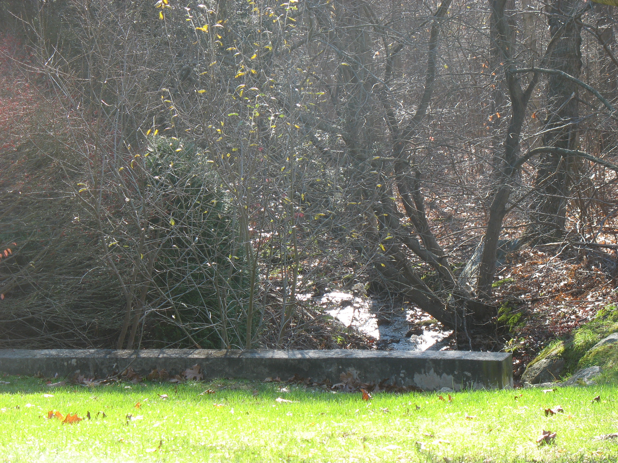 This
property contains wetlands associated with a small stream that crosses
Honeybee Lane.
This
property contains wetlands associated with a small stream that crosses
Honeybee Lane.
Access: There is no formal access. The property has 25 feet of road frontage between houses #33 and #37 Honeybee Lane.
Maps & Photos
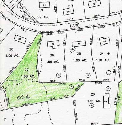 Tax Accessor's Map
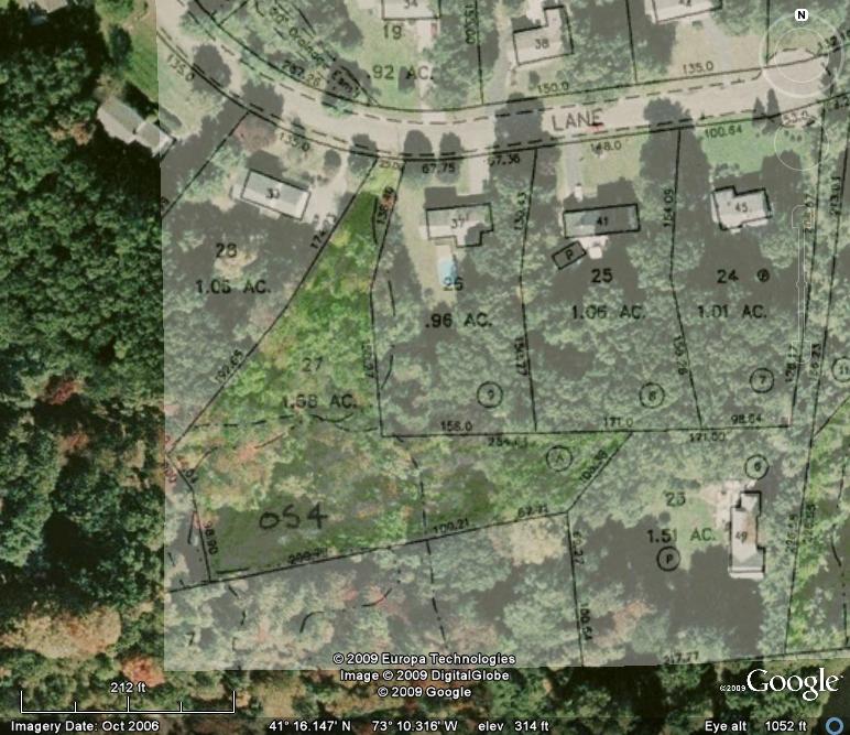 Tax map overlay on aerial
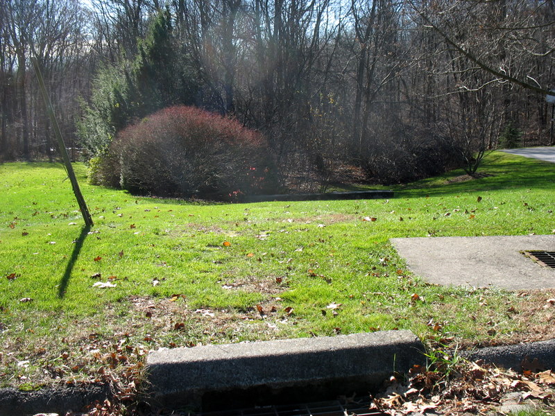 Open Space road frontage
Deed Information
Volume 416 Pg 123: Acquired from James Bargas Development Corporation for $1, property known as Parcel "A" on map entitled, "Section Two, Honey Hill, A Subdivision of Land in Shelton & Trumbull, Con. Prepared for James Bargas", dated December 4, 1974, revised January 27, 1975. Filed map Volume 26 page 1279.
Filed map Note 9 states: "Parcel 'A' is to be deeded to the City of Shelton for open space use.