Conservation Commission
Shelton, Connecticut
 OPEN
SPACE MENU
OPEN
SPACE MENU
Open Space Links
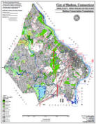
Open Space Map (3mb)
City of Shelton Open Space Marker
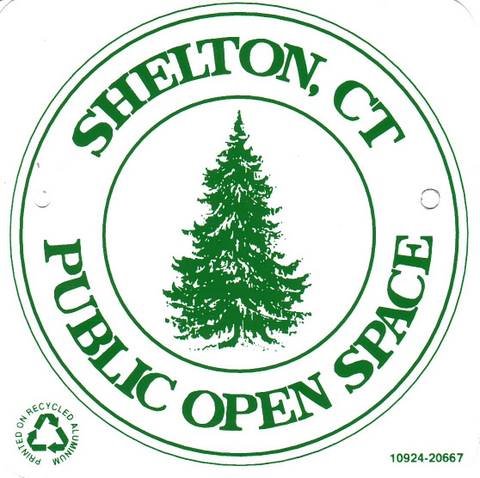
This marker is used to identify Public Open Space owned by the City of Shelton. It does not mark the exact location of the property line and may be as much as 100 feet away from the boundary, depending on site conditions. The Conservation and Pedestrian Easements markers have a similar look but different text.
Land Trust Marker

The Land Trust is a private, non-profit group that owns 364 acres of open space in Shelton, marked with these signs. People frequently confuse the Land Trust with the City of Shelton.
Wetlands Marker
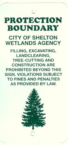
These rectangular wetlands marker may be found in some newer subdivisions, usually on 4x4 posts. They mark the location of areas regulated by the Shelton Inland Wetlands Commission. These are generally on private property and are not related to open space.
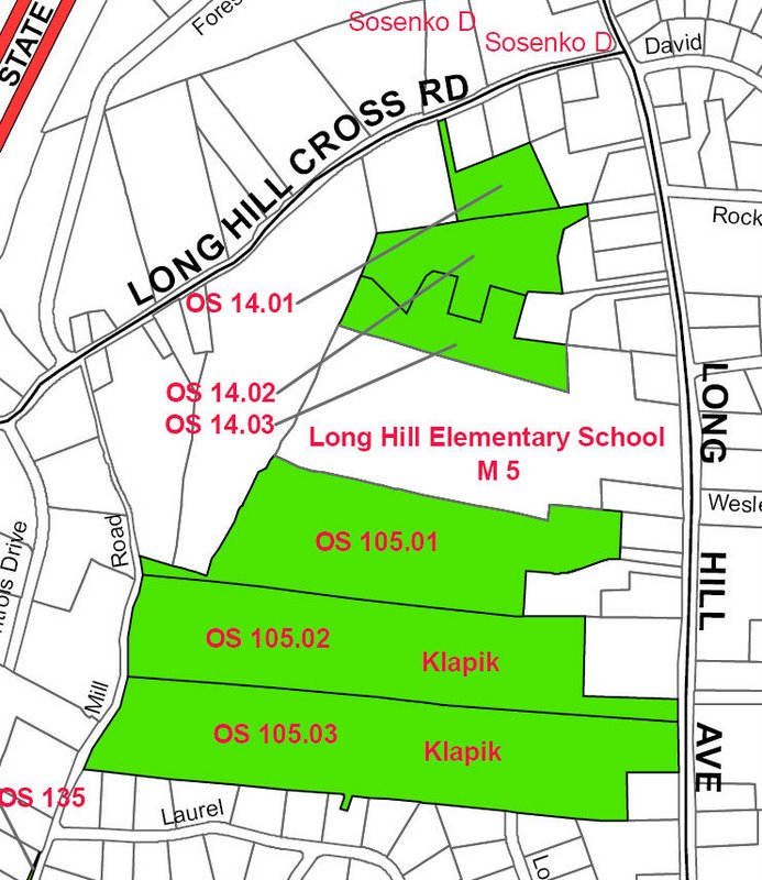
OS 105 Klapik Farm (58.4 acres)
Long Hill Avenue, Longview Road, Long Hill School
(OS 105.01, 105.02 and 105.03)
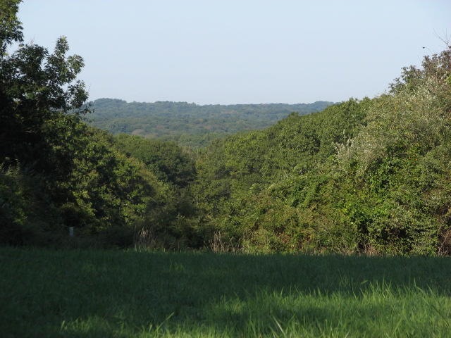 This
mix of forest and hayfields does not have any official trails at this
time, although there are some old woods roads that are used by neighbors.
The hayfields are harvested under an annual license granted by the City.
The three parcels that make up the Klapik open space abutt wooded portions
of Long Hill School and other open space lands to the north, so the entire
open space corridor is closer to 100 acres.
This
mix of forest and hayfields does not have any official trails at this
time, although there are some old woods roads that are used by neighbors.
The hayfields are harvested under an annual license granted by the City.
The three parcels that make up the Klapik open space abutt wooded portions
of Long Hill School and other open space lands to the north, so the entire
open space corridor is closer to 100 acres.
A portion of the meadow area may be used for a future Community Garden.
The combined acreage of all the fields is 15 acres. Invasive Russian and/or Autumn Olive shrubs are growing along the perimeter of the fields and encroaching steadily into the fields. Since the permeter of the fields totals about 3 miles, removal is difficult. These shrubs are not native to American, however, they do provide some food and shelter value to wildlife.
Maps and Photos (click to enlarge)
 Open Space Map
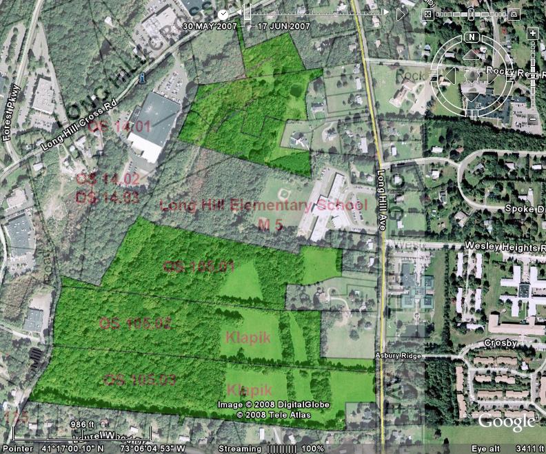 Open Space/Aerial overlay
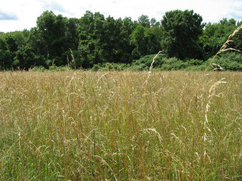 Hayfields
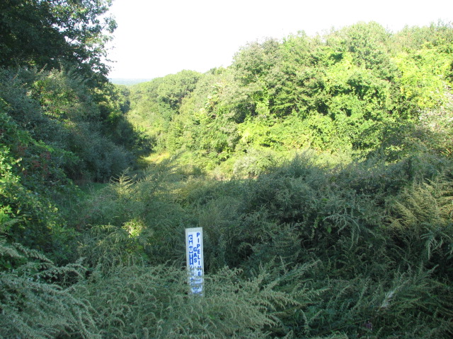 Iroquois Pipeline
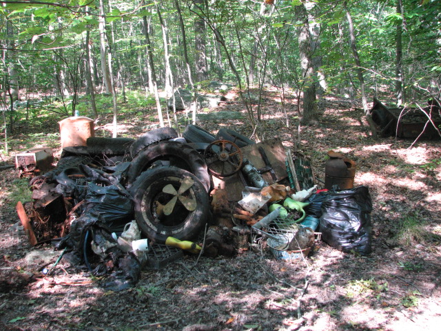 A pile of debris pulled out of a swamp needs removal - good volunteer
project for Shelton Clean
Sweep.
A pile of debris pulled out of a swamp needs removal - good volunteer
project for Shelton Clean
Sweep.
 "Prime" and "Important" farmland soils
per
state map.
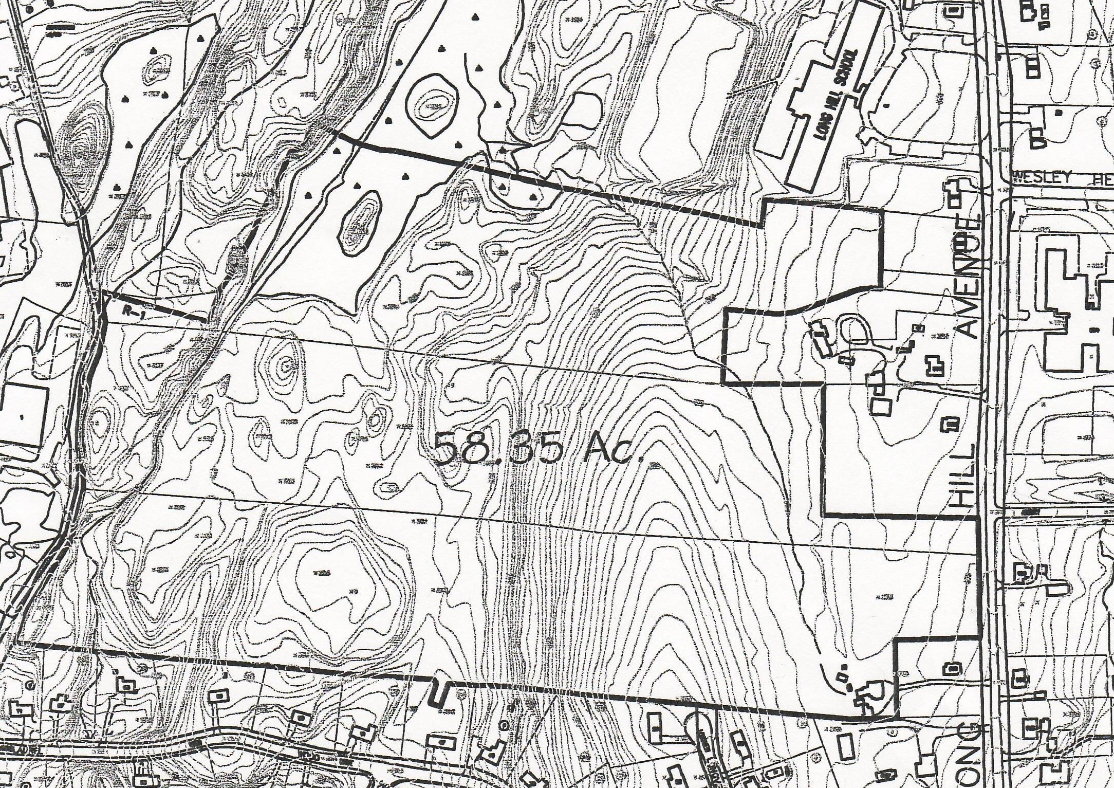 Topographic map
 Topo-aerial overlay
 Two possible sites for a new community garden (added Feb 2010).
Deed and Filed Maps
OS 105.01 (the northern parcel abutting Long Hill School - 16.35 acres) was purchased in 2000 for $400,000. There are no restrictions on the deed, which is filed at Book 1662 Page 312, with reference to filed map Vol. 33 Page 2013 with exceptions per the deed.
OS 105.02 (22.84 acres) and 105.03 (19.16 acres) were purchased in 2002 for $2,000,000 and recorded at Book 1970 page 60. There are no deed restrictions.